Sharpen Your Knowledge with Esri (EADP19-001) Certification Sample Questions
CertsTime has provided you with a sample question set to elevate your knowledge about the Esri ArcGIS Desktop Professional 19-001 exam. With these updated sample questions, you can become quite familiar with the difficulty level and format of the real EADP19-001 certification test. Try our sample Esri ArcGIS Desktop Professional 19-001 certification practice exam to get a feel for the real exam environment. Our sample practice exam gives you a sense of reality and an idea of the questions on the actual Esri ArcGIS Desktop Professional certification exam.
Our sample questions are similar to the Real Esri EADP19-001 exam questions. The premium Esri ArcGIS Desktop Professional 19-001 certification practice exam gives you a golden opportunity to evaluate and strengthen your preparation with real-time scenario-based questions. Plus, by practicing real-time scenario-based questions, you will run into a variety of challenges that will push you to enhance your knowledge and skills.
Esri EADP19-001 Sample Questions:
An ArcGIS user requests polygon parcel data to use in a model linking geoprocessing tools. The data the user receives covets the entire country and the large dataset causes the application to perform slowly.
How can the ArcGIS user improve the performance time without altering the model?
An image that is displayed as draped over a digital elevation model (DEM) in ArcGlobe appears to be overly pixilated. Which property should be changed to make the image appear smoother?
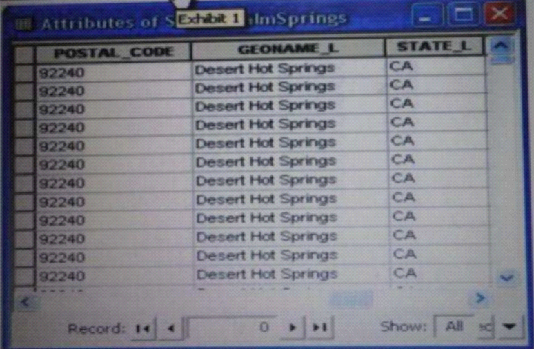
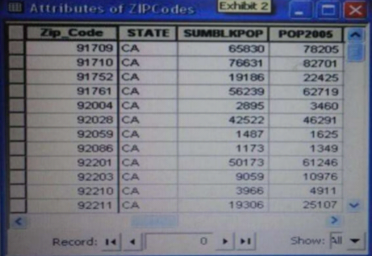
Refer to the exhibits.


An ArcGIS user is attempting to create a relationship class between the two tables shown in the exhibit using POSTAL_CODE and Zip Code as the origin primary key and destination foreign Keys, respectively. However when the user tries to set the keys zip Cede does not appear in the drop-down list of candidate keys
What should the user do to successfully create the relationship class?
A user wants to connect new laterals to supply water to newly built houses. What edge type supports this function?
An ArcGIS user runs the Central Feature geoprocessing tool on a polygon feature class. The output feature is far north of the center of the feature class
Why Is the output feature off center of the feature class?
Note: If there is any error in our Esri EADP19-001 certification exam sample questions, please update us via email at support@certstime.com.


 Try Before You Buy!